PHOTO
AMMAN — Scholars Fawzi Abudanah and Mark Driessen distinguished three ancient agro-hydrological systems in the Udhruh region, some 15 kilometres east of Petra.
These are systems that harvest water from different sources and for different purposes, although agricultural use is predominant.
"It is our aim through this project to improve the understanding of the hydro-technological innovations and major societal transformations that took place from Nabataean to Islamic times, in the wider region," said Abudanah.
He added that it has been observed that large parts of these ancient water-harvesting and agricultural field schemes are still largely intact and partly buried by alluvial deposits.
To achieve their goal, the professors and their team of young scholars combined archaeological analyses, antique written sources, geophysical, geo-hydrological, socio-hydrological, bio-scientific and bio-geochemical soil studies.
Udhruh hosted one of the most reliable perennial springs – ‘Ain Udhruh –for the entire region. Its water most probably comes from the undulating slopes of the Jabal Sharah and Zebyriya ridge towards Petra, further fed by tributaries from the Wadi Mulqan and Wadi Rumayi, and was transported by aquifers from the Wadi Sir Limestone and possibly higher-lying formations.
This spring was the prime location factor for early occupation, and can be linked to the continuity of human activity pre-dating the Persian period,” Abudanah elaborated.
"Udhruh housed an important Nabataean settlement and most likely developed as a second Nabataean nucleus in the hinterland of Petra, before it was redesigned as a Roman military base," Driessen said, adding that the Nabataean people did transform the steppe region around Petra into an agricultural landscape consisting of new settlement, water-harvesting and construction works, and arable fields.
Between 2nd and 1st centuries BC starts the Nabataean sedentary life and they relied more on agriculture.
"The Udhruh settlement and its perennial source of water were of pivotal strategic importance to the Nabataeans as they constructed an elaborate communication system for the whole region.
By the time they had constructed the system, all separate watchtowers and fort lets had a direct visual connection with the higher parts of this settlement," Driessen underlined, explaining that it was a multi-purpose system as this communication system was kept in use for the protection of field systems established later, during the Roman and Byzantine periods.
The spring of Udhruh was an important factor in the choice of location for the Roman camp, Driessen noted, adding that in Roman times access to this water resource was at the north-east side of the fortress, where a natural depression leads to the present-day spring.
Abudanah said: "This connection to the spring and to the control of this important water source is most probably the reason why this side of the castra has an atypical trapezoidal shape. Another unusual feature that struck us immediately was the slope on which the fort was built. These somewhat odd characteristics were necessary both to incorporate the source of water, and to provide a territorial marker connecting to all the watchtowers in the surrounding region."
The towers were constructed with the intention that they would withstand potential earthquakes, and with measures to enable good air circulation.
"There were even large cisterns in some of them. The south-east corner tower used to house a large antique cistern, which was in use until recently, when it was closed because of the risk to playing children and animals," Abudanah outlined, adding that the visible network of water-distribution channels, diversion structures, barriers and even spillways give a good impression of how the system must have operated in those days.
"In 2014 we saw this water-distribution system in operation for the last time, no longer fed by the ancient spring but through a modern water supply system. The distribution was the responsibility of the men, who worked out a water-management schedule at the community level. ‘Ain Udhruh is considered of high importance because of its creation and maintenance of a shared sense of identity and spiritual meaning for the people of Udhruh," Driessen underlined.
The spring fell dry as the result of a combination of changing climatic conditions, sinking groundwater levels and, according to local people, construction failures by the government when they built the nearby road, scholars explained, adding that the ground water levels will be further lowered by recent attempts at ‘hit-and-run agriculture’, a problem that is noticeable over the whole region.
"We call it ‘hit-and-run agriculture’ because it is definitely not permanent, nor sustainable, and the growers seem to be interested only in a quick profit. Some of the more fertile soils were selected for this activity for large-scale one-year cultivation sites; an enormous waste of precious water appeared to take place, probably resulting in serious salinisation of the soils," Abudanah explained.
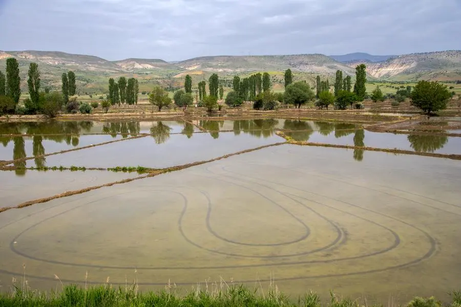
Irrigation and water distribution was practiced during the Nabataean time and archaeologists found fragments of the ancient irrigation and water harvesting system.
"The literary sources provide us with intriguing examples as well, especially for the Byzantine and early Islamic periods. In the light of this the Petra papyrus interest, it describes a dispute between two neighbours in a nearby settlement over water-draining rights from a spring and the theft of building materials and the construction of water channels," Driessen underlined.
© Copyright The Jordan Times. All rights reserved. Provided by SyndiGate Media Inc. (Syndigate.info).
